Distribution maps
 As part of the preparations for the Dipterists Forum annual workshop in 2018, the recording scheme has produced a draft atlas, containing distribution maps for all the scheme species in Britain. It is available for download (PDF, 16MB) here:
- Harvey, M.C. 2018. Provisional atlas of soldierflies and allies. Draft version.
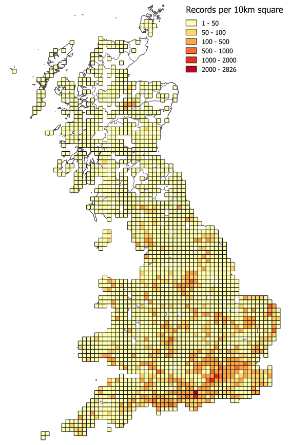
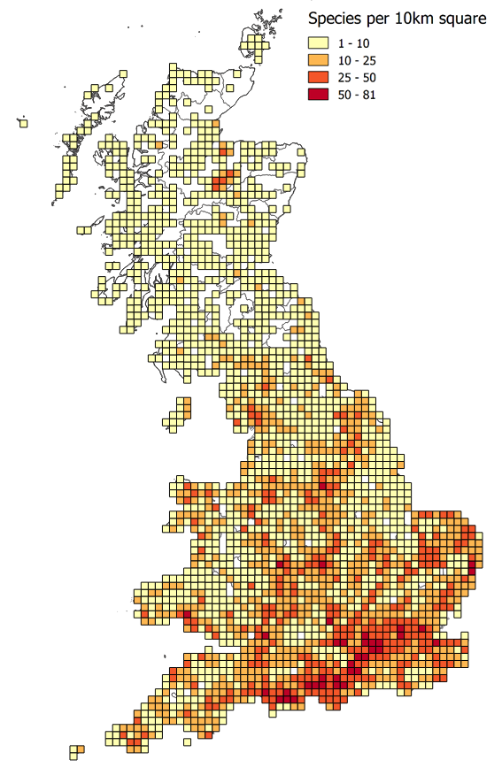
A text summary and map is provided for each species, arranged alphabetically by family and then by species. The maps are based on data from the recording scheme database (including data from iRecord) up to 15 January 2018 (just over 100,000 records), plus additional data from numerous sources as displayed on the NBN Atlas at February 2018 (just over 50,000 records). Maps are colour-coded to show records from before 1970, 1970 to 1999, and 2000 onwards.
Please contact the scheme if you know of records that are missing from these maps, or if you see records mapped that you think are in error.
Caveats:
- Verification has been carried out on most of the recording scheme data, but so far on only a small proportion of the data sourced via the NBN Atlas. The maps will include a number of errors; where these are believed to be significant a note on caveats has been added.
- There is still some recent data waiting to be incorporated into the recording scheme database.
- On the maps the recording scheme data is shown as the top layer, which means that in some cases there may be records on the NBN Atlas from a more recent time-period than shown by the recording scheme 10km squares.
Acknowledgements:
Many thanks to c. 3,000 people who have sent in records for the last 200 or so years, and to my predecessors as recording scheme organisers who built the firm foundations on which this atlas is constructed: Tony Irwin, Martin Drake and Simon Hayhow. Thanks to Malcolm Smart for expert advice and assistance with checking the records of Asilidae (robberflies). Thanks also to Steph Rorke, Jim Bacon and colleagues at the Biological Records Centre within the NERC Centre for Ecology and Hydrology, for providing database and website support.
Previous atlas:
- Drake, C. M. 1991. Provisional atlas of the larger Brachycera (Diptera) of Britain and Ireland. Abbots Ripton, Huntingdon, Biological Records Centre Institute of Terrestrial Ecology, 131pp.